
Drawing Data on Maps: Sketch-Based Spatiotemporal Visualization
Best Poster Honorable Mention
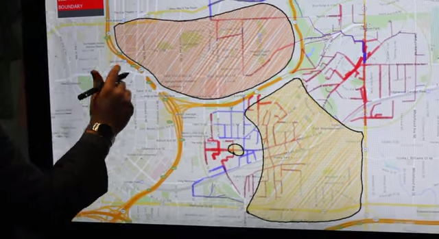
Spatial data is frequently used in urban planning contexts to support decision-making. This data can be used to plan routes through the city for public transportation or to designate zones for planning new businesses and residences. Unfortunately, few tools exist that allow non-programmers to rapidly utilize spatial data to create such plans. In this poster, we present SpaceSketch, a tool for rapidly constructing map-based visualizations using spatial data. SpaceSketch utilizes a sketch-based approach to visualization specification in which hand-drawn trajectories and regions are encoded using a user-specified model. Using SpaceSketch, map-based plans can be rapidly constructed, compared, and altered on a multitouch canvas.
Authors
Godwin, A. and Stasko, J.
Venue
2015 Proceedings of the IEEE International Conference on Visualization (VIS)